The Colombian department that is home to the 'eighth natural wonder of the world' and stands out for its impressive landscapes.
In Colombia, only one department has the privilege of being bathed by the waters of the Orinoco River, the third largest river in the world, which also runs along the Venezuelan banks . In its waters, thousands of years of biodiversity formation emulate scenarios that, if undocumented, could easily be mistaken for other worlds.
It's no coincidence that biologist Alexander von Humboldt discovered a rapid in the middle of the mountains, which he called the eighth natural wonder of the world. Between plains, tepuis, and vast floodplain forests, the department of Vichada is a paradise almost untouched by man.
Puerto Carreño: reddish streets on the banks of the Orinoco
Amidst the sounds of vallenato music and the bustle of the people, the capital of the department that defines itself as a land for the landless rises. A small municipality in the middle of the plains, with streets marked by reddish gravel, is the first stop to discover the gifts nature has bestowed upon this territory.
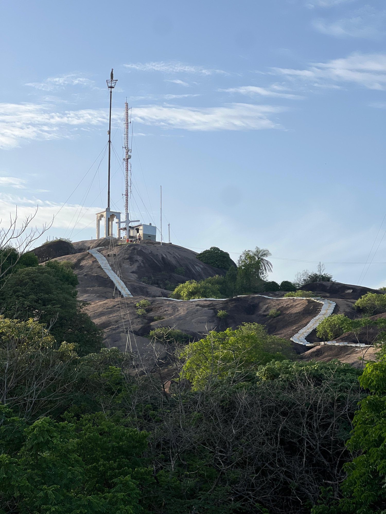
Flag Hill, Puerto Carreño.Photo:Sergio Andrés Gamboa Mendivelso - El Tiempo
From Flag Hill, you can clearly see how the trees mark the border between Colombia and Venezuela . The murmur of the Orinoco River and the sun, which rises earlier than in other parts of the country, announce the beginning of each day for the thousands of people who, far from the immediacy of large cities, live their lives alongside the river.
Upon entering the river, there is no other means of transport than canoes that carry people across the waters of the Orinoco to discover the first of this territory's wonders: the Bita River, the best-preserved in the country . The crystal-clear waters of this body of water, along with the rapid flow of the river into which it flows, create the perfect ecosystem for thousands of plants to thrive below and on the banks.
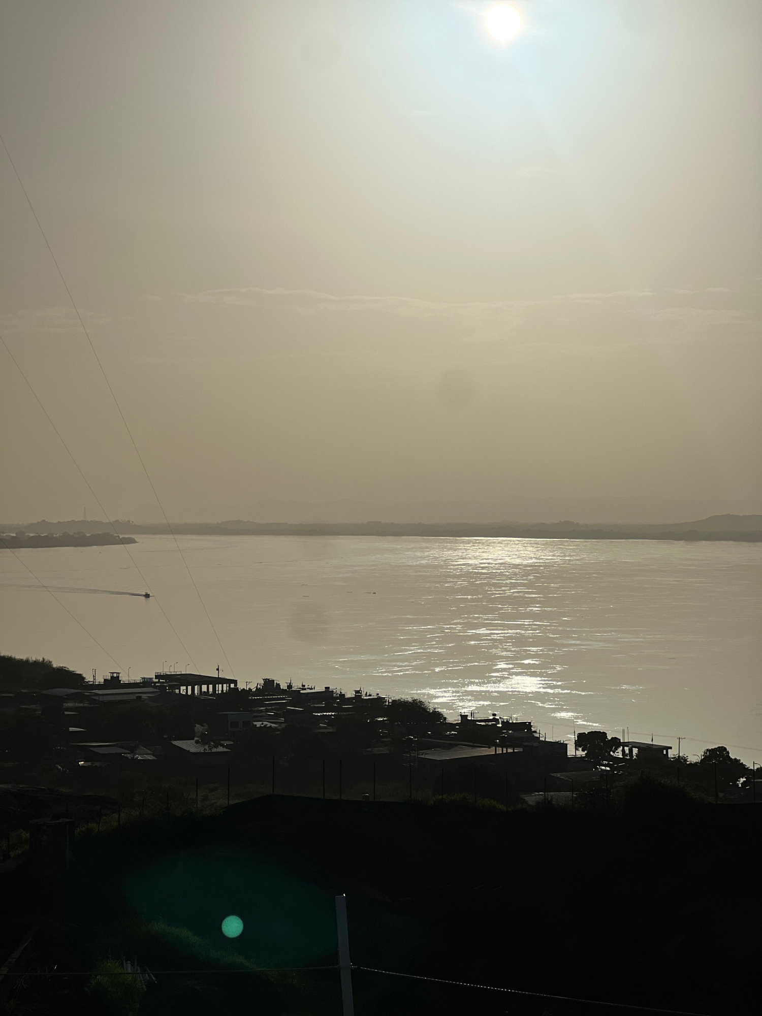
View from Flag Hill, Puerto CarreñoPhoto:Sergio Andrés Gamboa Mendivelso - El Tiempo
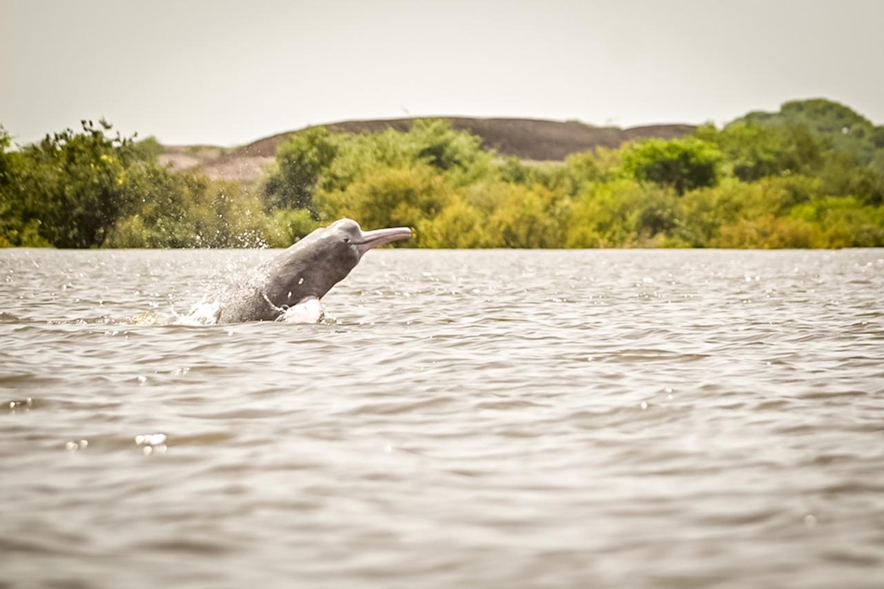
The sounds of the boats act as a call to the pink dolphins, who, upon hearing them, think there will be fishing and come to the surface for a few seconds to catch their breath.
Pink dolphin in the waters of the Bita River.Photo:ANATO
Tambora: the gateway to El Tuparro National Park
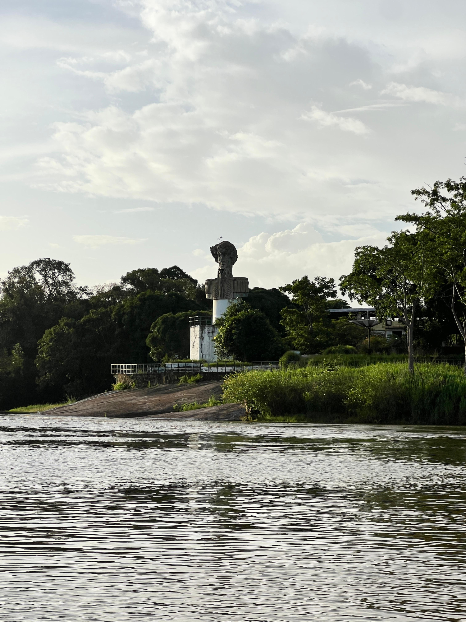
After spending several hours on a road trip through plains, mountains, and small towns located along the border, a one-and-a-half-hour boat ride begins to uncover the mysteries of an immense jungle inhabited by fishermen. The destination: Tambora, a territory where a statue of Simón Bolívar is evidence of what was once a large rehabilitation complex for people from the Bronx, in Bogotá.
Tambora used to be a rehabilitation center for homeless people in Bogotá.Photo:Sergio Andrés Gamboa Mendivelso - El Tiempo
Beside it, the small camp created by Don Rosevelt Rodríguez, a man who knows the routes through the forest and the National Park as if they were marked out by imaginary streets in his mind. There, in the middle of the jungle where, ironically, the signal is better than in the departmental capital, the sun filters through the leaves of the thousands of trees that make up a landscape that changes depending on the time of year.
There is "summer" and "winter." In the former, extensive beaches invite tourists to walk the land and swim in the waters surrounding the gallery forests; in the latter, the areas where beaches and tall trees once stood fill with water, allowing visitors to sail above their canopy.
The river becomes a mirror that covers even the treetops.Photo:Sergio Andrés Gamboa Mendivelso - El Tiempo
El Tuparro: the house of biodiversity and the viewpoint to the eighth wonder
In ancient times, when the area was only inhabited by indigenous communities like the Sikuani, they named one of the rivers Tuparro. Although the meaning is unclear, it could refer to the aggressiveness of its waters, which acted as a "graveyard" for those who challenged them. From this, the National Park of the same name was derived, encompassing five representative ecosystems: dry savannas, floodplains, gallery and terra firme forests, and rocky outcrops.
The park covers approximately 557,000 hectares and is home to thousands of species living among the savannas, mountains, rivers, rapids, and tepuis. Humidity is no impediment to hiking the trails and discovering, amidst the vast expanse, springs that make the large rocks appear to sparkle.
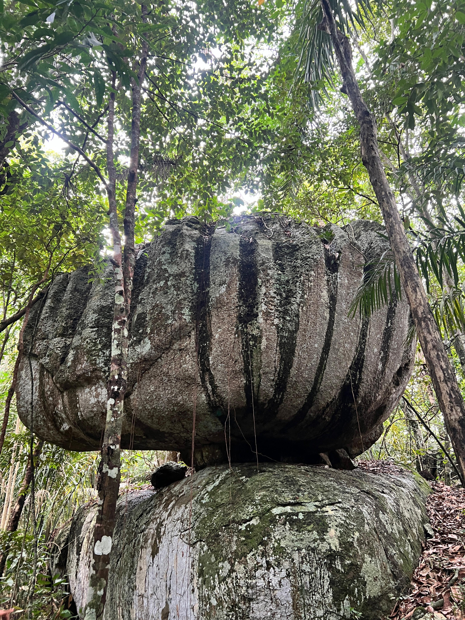
Calabaza Stone on the Atalea Trail.Photo:Sergio Andrés Gamboa Mendivelso - El Tiempo
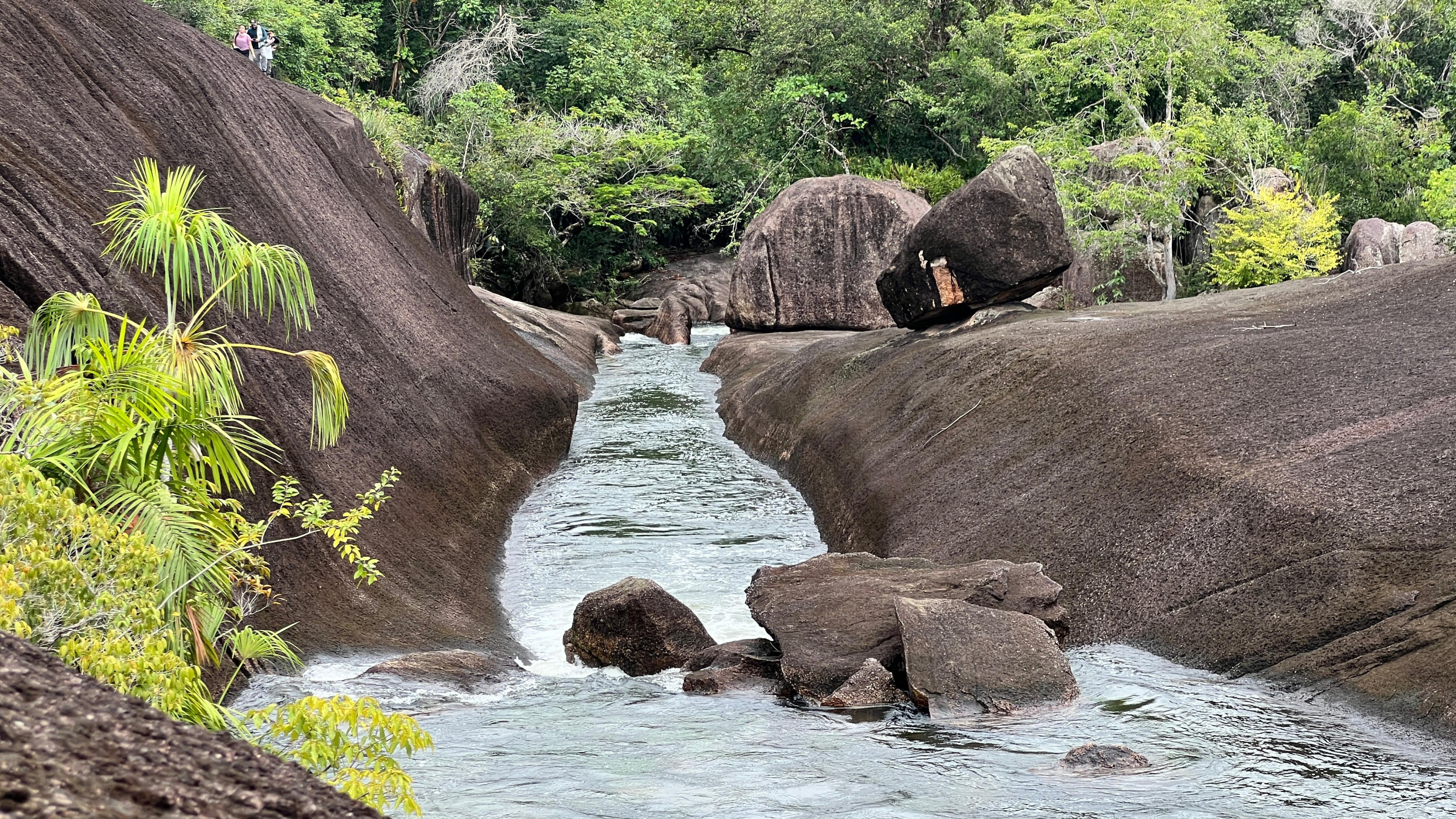
After walking with the guide of a member of the Sikuani community, known as Palma, into the mountains of the park, the rocks begin to look as if they were balanced by strange forces. A formation between two large rocks, formed by water over millions of years, forms Caño Lapa, a corner of the jungle where a natural slide forms, colored green by algae.
Caño Lapa, a hidden treasure within the park.Photo:Sergio Andrés Gamboa Mendivelso - El Tiempo
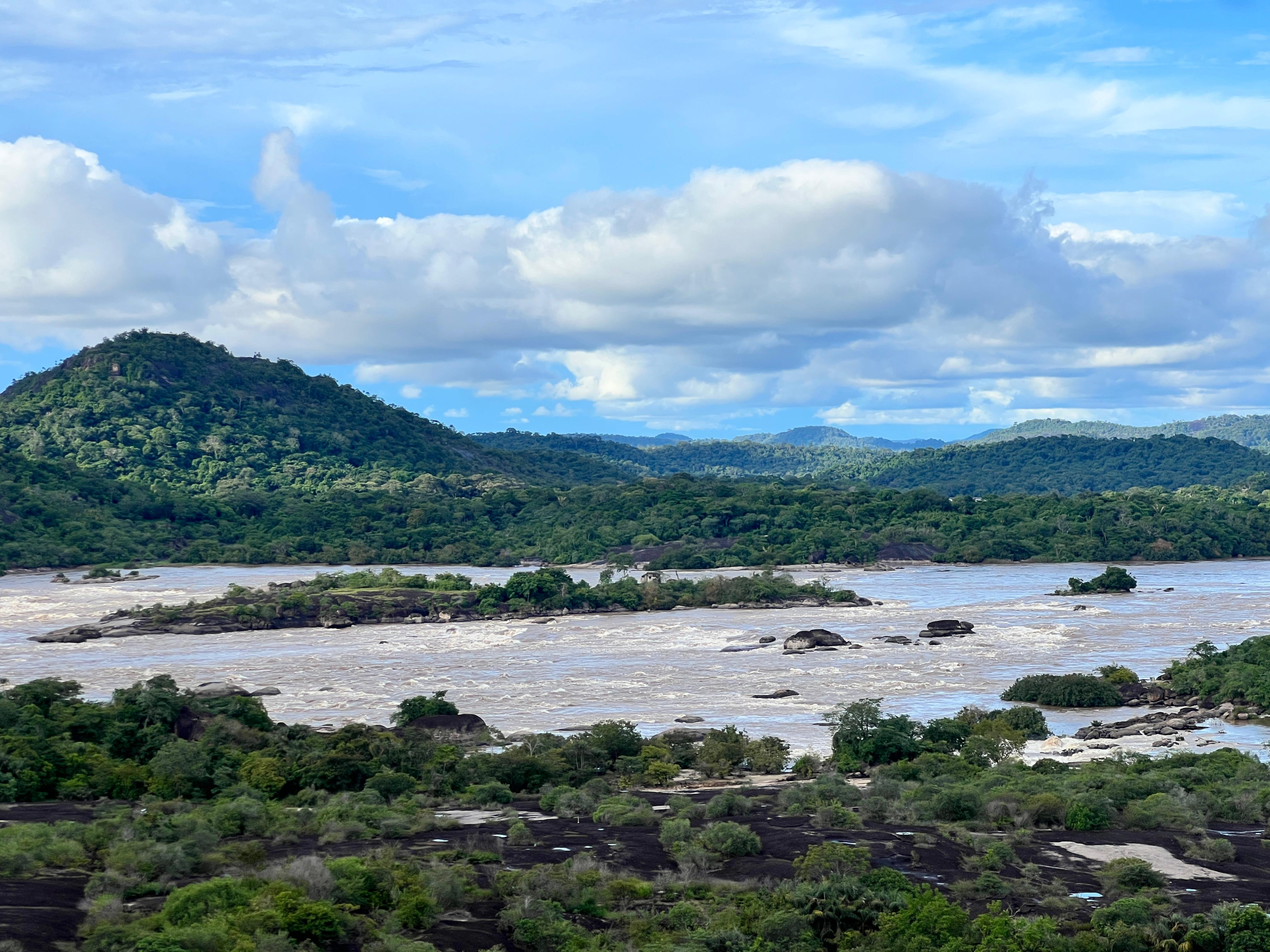
In another part of the park, after several minutes of walking through the forest and seeing stones like the "Pumpkin Stone," the Atalea trail ends at one of the most beautiful viewpoints in all of Vichada. From the top of the Tepuy, you can see the immensity of the Orinoco River and, to one side, its aggressiveness, reflected in the rapids of Maipures, described as the eighth natural wonder of the world by biologist Alexander Von Humboldt.
The rapids transform the murmur of the river into an impressive roar, demonstrating the impossibility of navigating the rapids. The large stones next to the Tepui make the water gain speed, transforming it into a spectacle for any spectator who, amidst the water, birds, plants, and rocks, would be mesmerized by the immensity of this divine work.
Maipures Rapids in El Tuparro National Park.Photo:Sergio Andrés Gamboa Mendivelso - El Tiempo
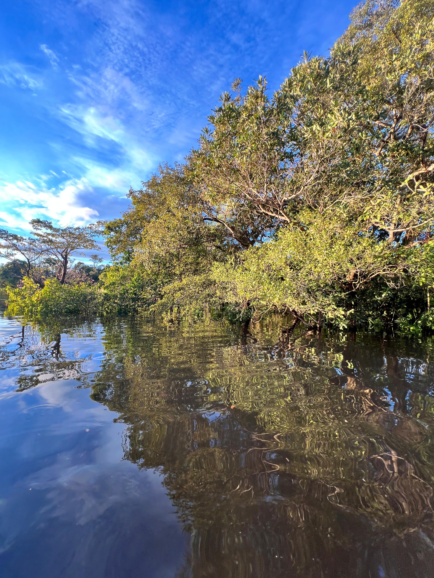
A forest that floods until it allows sailing alongside the treetops
All day long, during closed seasons, people from both sides of the border who make their living from fishing come out from the riverbanks. With their huge cast nets, they perform a choreography every time they see the movement of fish in the water, hoping to catch and sell them.
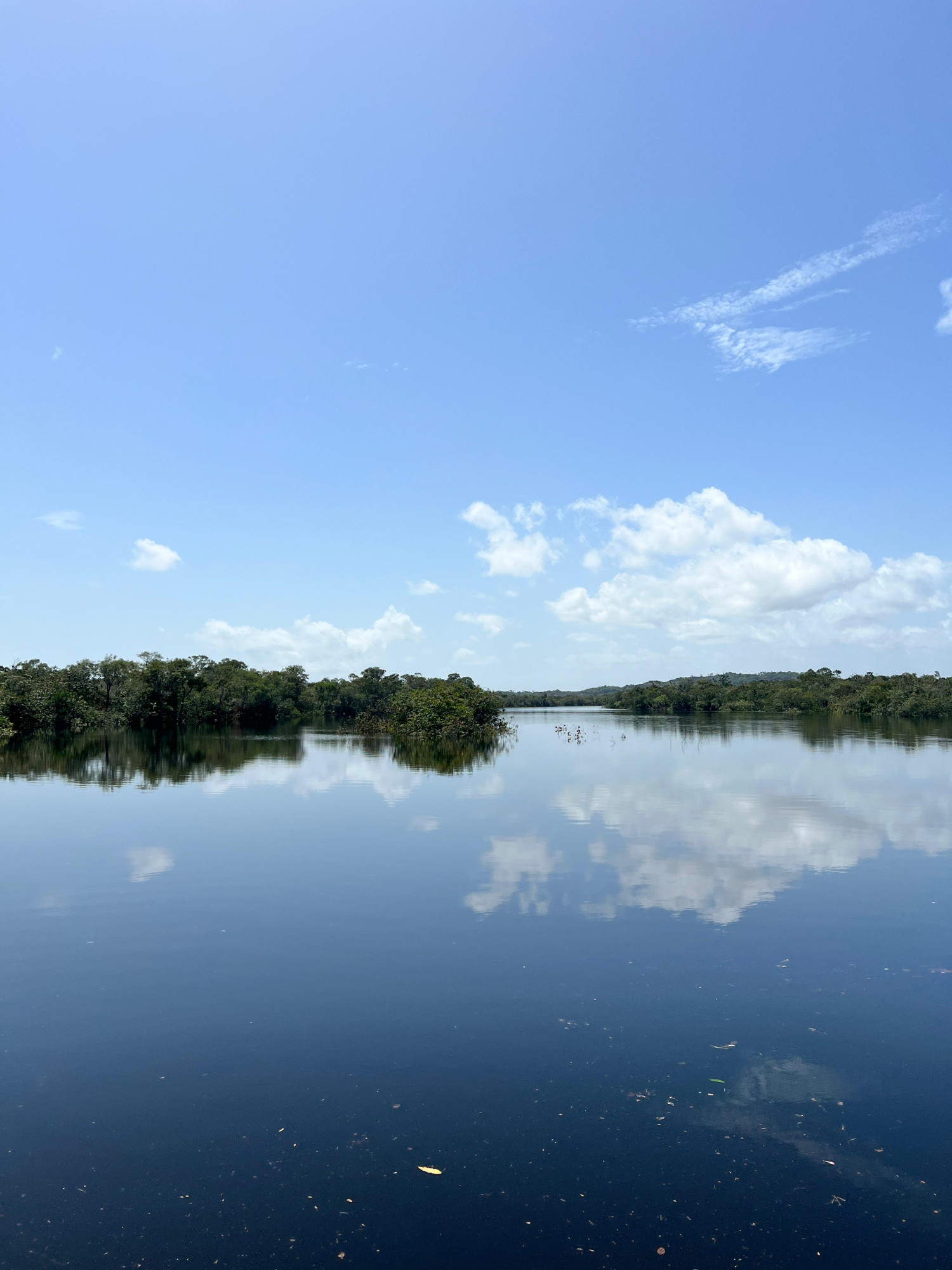
Light shares the spotlight with water, which, when seemingly still, acts like a large mirror that seems to duplicate the natural wonders of the mountains and forests. In one section of the park, one of these flooded forests transforms what was once savanna into a branch of the Tomo River . The Tomito River forms, allowing passersby to walk alongside the treetops that were flooded during the winter, as if floating through the sky.
Tomo and Tomito Rivers, Vichada.Photo:Sergio Andrés Gamboa Mendivelso - El Tiempo
The department of Vichada, along with the El Tuparro National Park, the waters of the Orinoco, the rapids of Maipures, the tepuis and the multiple ecotourism attractions it houses , is positioned as a hidden destination in Colombia that has the potential to be visited by the most daring or by those who want to corroborate that Colombia, indeed, is the country of beauty.