
How Tropical Storm Imelda will impact the Southeast

Tropical Storm Imelda won’t make landfall in the United States.
Tropical Storm Imelda won’t make landfall in the United States, but it will skirt close to the Southeast coast, bringing rain, high surf and dangerous rip currents.
Here’s what you need to know:
Imelda is expected to strengthen to a Category 1 hurricane by Tuesday morning and then strengthen a bit more on Wednesday as it moves away from the U.S. coastline and toward Bermuda. By Wednesday evening, Imelda could near Bermuda as a Category 2 hurricane. The storm will then head out to sea on Thursday morning.
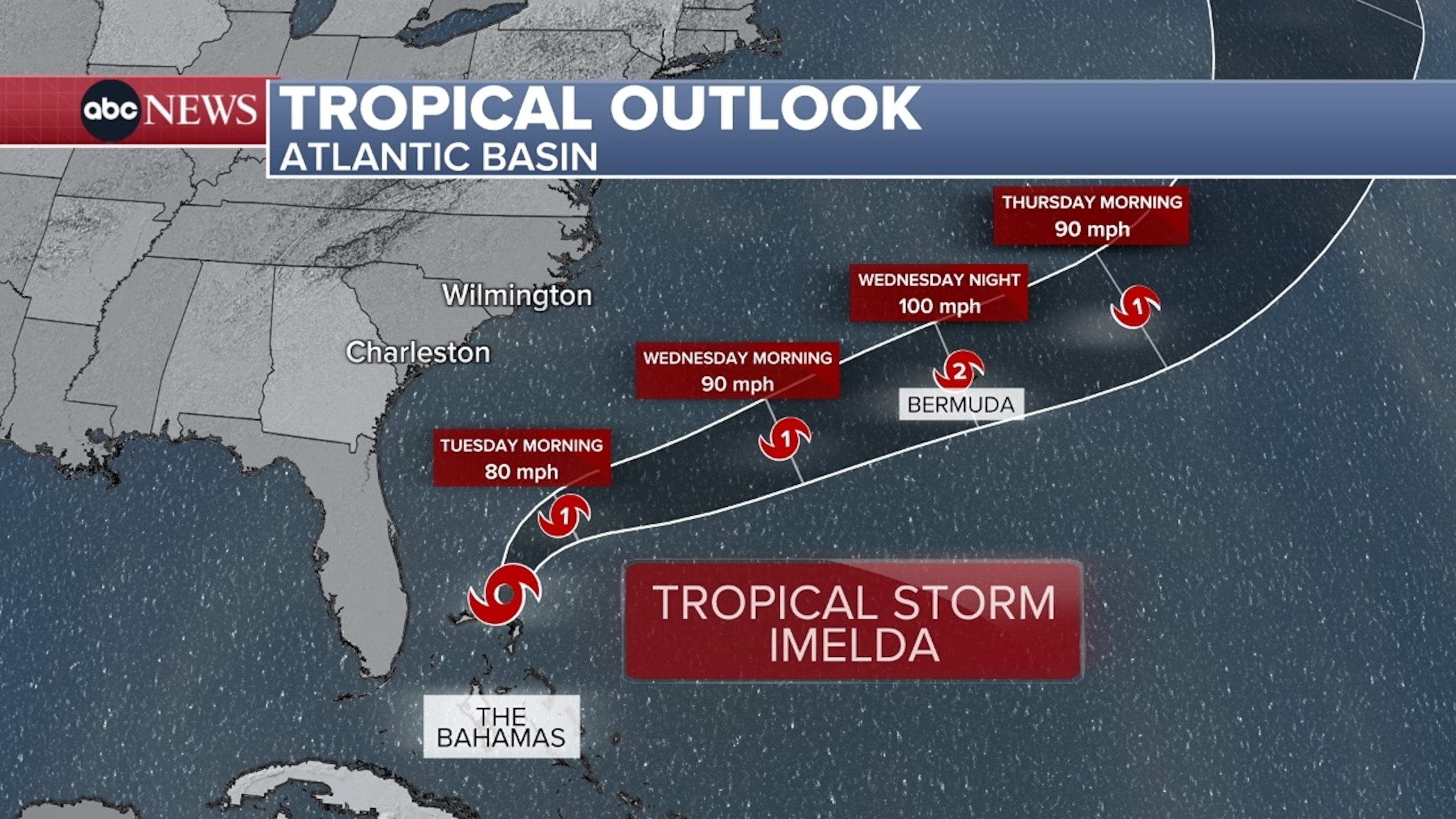
Imelda could bring rain and wind to Florida on Monday, with gusts up to 40 mph possible along the Central Florida coast.
The rain will also reach the Carolinas on Monday and Tuesday.
But the biggest impact from Imelda will be several days of dangerous surf and rip currents from Florida to the Mid-Atlantic.


Life-threatening rip currents are forecast for beaches in Florida, Georgia, South Carolina and North Carolina.
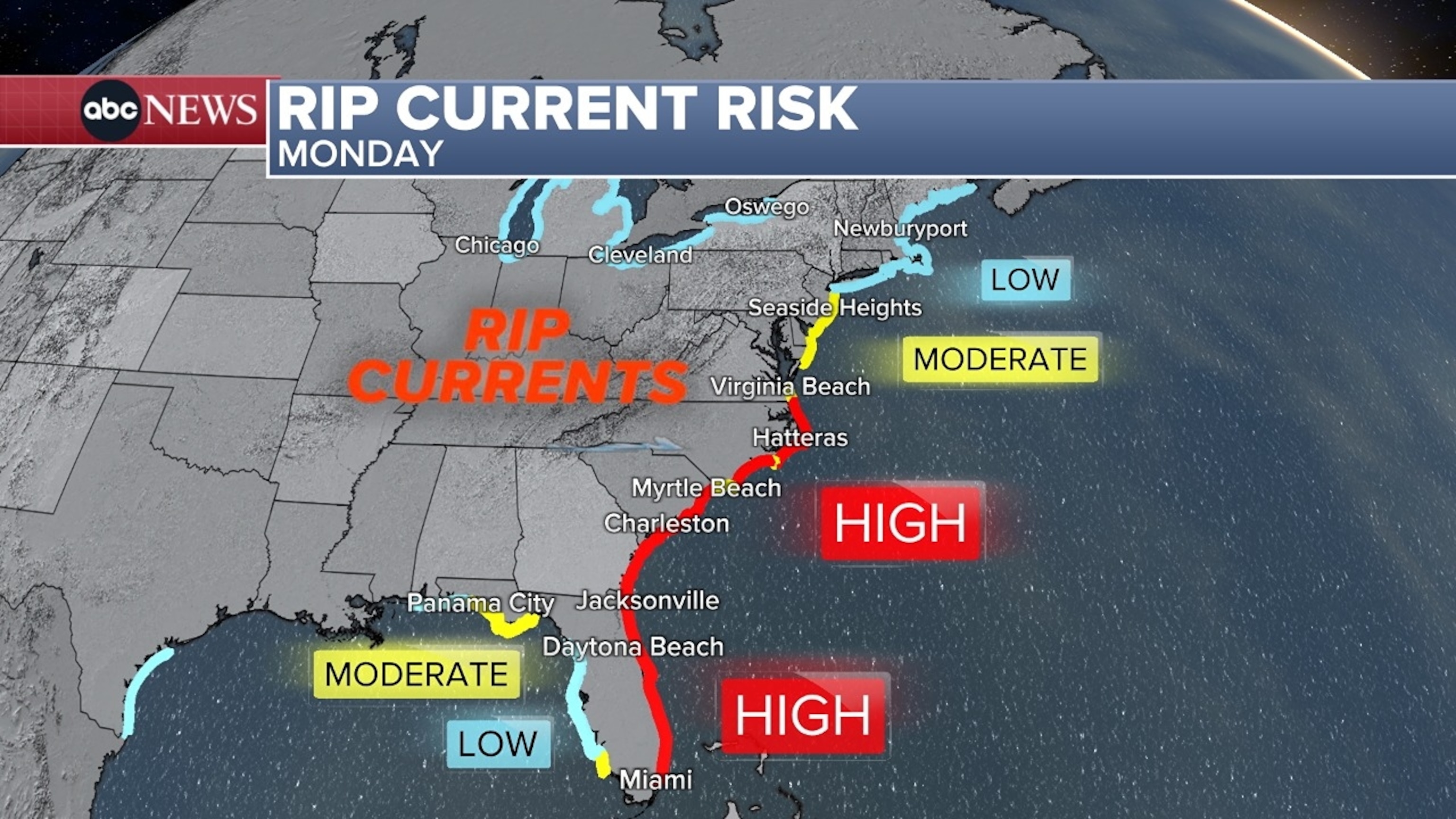
High surf alerts are in effect along the coast from Port St. Lucie, Florida, to North Carolina’s Outer Banks to Virginia Beach, Virginia. Waves could reach 7 to 11 feet in Florida and Georgia on Monday and Tuesday, while waves could hit 5 to 10 feet in the Carolinas and Virginia from Tuesday to Thursday.
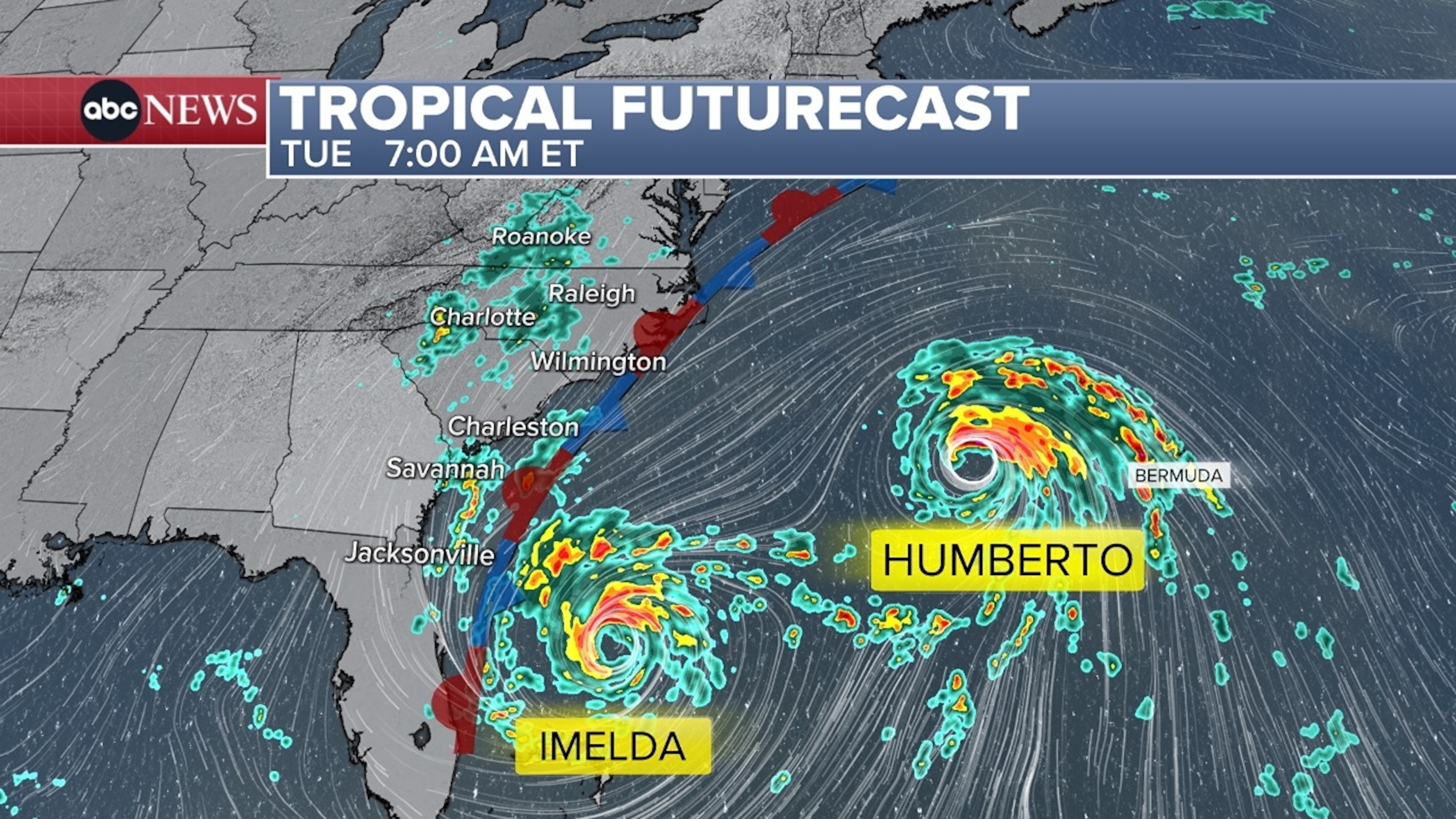
Meanwhile, Humberto, a Category 4 hurricane, will bring heavy rain to Bermuda on Tuesday. Humberto will then continue to move northeast out into the Atlantic.
ABC News


